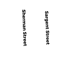
9 SARGENT ST
Owner Information
KOWALSKI, MARY ANN &
9 SARGENT STREET
CAMBRIDGE, MA 02140-2513


Property Details
9 SARGENT ST is classified as a Two-Family Residential (Old style two fam).
The primary structure on this property was built in 1850. There are 3,653ft2 of built area within this property. There is 2,025ft2 of residential/living space within this property. This property is listed as having 9 rooms. There are 2 units within this property.
9 SARGENT ST is valued at $926,000. The land is valued at $578,500 and the structures are valued at $347,500.
This property is in Zone B. Confirm with local Zoning Board authorities to ensure there are no overlays or other easements on this property.
The most recent deed for 9 SARGENT ST is recorded at the local registrar in Book 27776, Page 0365. 9 SARGENT ST was last sold on Thursday, October 16, 1997 for $233,000.
Assessment data from fiscal year 2021.
Flood Data
According to the FEMA National Flood Hazard Layer, this property does not appear to be in a flood zone. It may also be in an area not yet reviewed. Nonetheless, confirm this information prior to taking any action.
To view the flood hazards around this property, create a FEMA "Firmette" Map of the area around 9 SARGENT ST.
Broadband Internet Providers
| Provider | Type | Bandwidth (mbps) | |
|---|---|---|---|
| netBlazr Inc | Fixed Wireless | 50 | 50 |
| GCI Communication Corp. | Satellite | 0 | 0 |
| Viasat Inc | Satellite | 100 | 3 |
| Starry, Inc. | Fixed Wireless | 200 | 200 |
| Comcast | Cable | 1000 | 35 |
| Verizon New England Inc. | DSL | 15 | 1 |
| VSAT Systems, LLC. | Satellite | 2 | 1 |
| HughesNet | Satellite | 25 | 3 |
Broadband service provider data from December 2020.
Adjacent Properties
- 190 SHERMAN ST
Single Family Residential owned by CAROLAN, JAMES R. & MICHELLE T. CAROLAN - 194 SHERMAN ST
Single Family Residential owned by KIEFSON-ROBERTS, RUTH & - 196 SHERMAN ST
Three-Family Residential owned by VOLCY, MIRLENE - 13 SARGENT ST
Three-Family Residential owned by ZHIMING, WANG - 7 SARGENT ST
Three-Family Residential owned by KOURKOUTAS, GARIFALIA